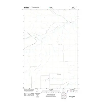
2011 Map of Strouf Island
USGS Topo · Published 2011About this map
Strouf Island sits as a prominent landform within this 2011 survey of Fergus County, Montana, where the winding path of Arrow Creek defines the local topography. The landscape is characterized by its drainage systems and agricultural infrastructure, notably featuring several uniquely named small reservoirs like Dienanira Dam, Cafe Mocha Dam, and Coffee Mate Dam. These water management features, alongside Cowboy Creek and Butte Creek, illustrate the vital role of water sourcing in this portion of the northern plains.
Find a feature on this map
17 named features on this map. Tap any name to fly to it.
Don’t see what you’re looking for? This feature index may not catch every label — zoom into the map to look around manually.
Map Details
Editions of this 2011 Strouf Island Map
This is the sole edition of this map. No revisions or reprints were ever made.
Other maps of this area

1890 · Fort Benton
USGS Topo · 1:250,000

1892 · Fort Benton
USGS Topo · 1:250,000

1897 · Fort Benton
USGS Topo · 1:250,000

1954 · Great Falls
USGS Topo · 1:250,000

1954 · Lewistown
USGS Topo · 1:250,000

1957 · Great Falls
USGS Topo · 1:250,000

1959 · Lewistown
USGS Topo · 1:250,000

1972 · Square Butte SE
USGS Topo · 1:24,000

1972 · Square Butte
USGS Topo · 1:24,000
1978 · Strouf Island
USGS Topo · 1:24,000