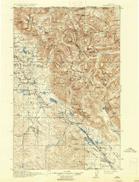
1916 Map of Stryker
USGS Topo · Published 1937About this map
The Whitefish Range and Flathead National Forest dominate this early 20th-century survey of the rugged Montana interior. The Great Northern Railway snakes through the valley floor, connecting remote rail settlements like Stryker, Trego, and Radnor. This transport corridor reflects the era's primary economic artery for timber and transit through the northern Rockies.
Find a feature on this map
120 named features on this map. Tap any name to fly to it.
Don’t see what you’re looking for? This feature index may not catch every label — zoom into the map to look around manually.
Map Details
Editions of this 1916 Stryker Map
3 editions found
Other maps of this area

1906 · Kintla Lakes
USGS Topo · 1:125,000

1913 · Stryker
USGS Topo · 1:125,000

1916 · Stryker
USGS Topo · 1:125,000

1920 · Jennings
USGS Topo · 1:125,000

1935 · Thompson Lakes
USGS Topo · 1:96,000

1938 · Kintla Lakes
USGS Topo · 1:125,000

1942 · Thompson Lakes
USGS Topo · 1:125,000

1943 · Kalispell
USGS Topo · 1:125,000

1957 · Kalispell
USGS Topo · 1:250,000

1960 · Kalispell
USGS Topo · 1:250,000