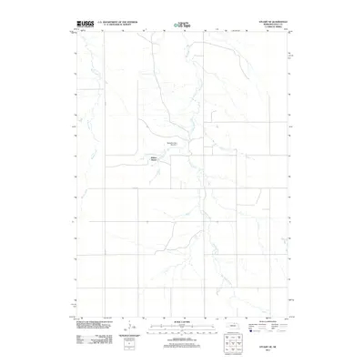
2011 Map of Stuart NE
USGS Topo · Published 2011About this map
Wilson Ranch serves as a focal point in this section of Holt County, illustrating the enduring cattle-ranching heritage of northern Nebraska. The landscape is defined by the branching hydrography of Big Sandy Creek and its various tributaries, including Conway Branch and Springs Creek. Water management and land use are evidenced by structures like McEachen Dam Number 1, which anchors the local drainage system. The map reflects a rural infrastructure built around large-scale landholdings and natural watercourses, with Beaver Creek flowing through the western portion of the quadrangle. Transport is facilitated by a grid of rural routes such as 469 Ave and 887th Rd, which segment the rolling plains and connect isolated homesteads and ranching operations.
Find a feature on this map
8 named features on this map. Tap any name to fly to it.
Don’t see what you’re looking for? This feature index may not catch every label — zoom into the map to look around manually.
Map Details
Editions of this 2011 Stuart NE Map
This is the sole edition of this map. No revisions or reprints were ever made.
Other maps of this area

1951 · Butte SW
USGS Topo · 1:24,000

1951 · Dustin
USGS Topo · 1:24,000

1951 · Naper SW
USGS Topo · 1:24,000

1954 · Stuart
USGS Topo · 1:24,000

1954 · Atkinson
USGS Topo · 1:24,000

1954 · Stuart SE
USGS Topo · 1:24,000

1954 · Stuart NW
USGS Topo · 1:24,000

1954 · Atkinson NW
USGS Topo · 1:24,000

1954 · Stuart NE
USGS Topo · 1:24,000

1955 · O'Neill
USGS Topo · 1:250,000