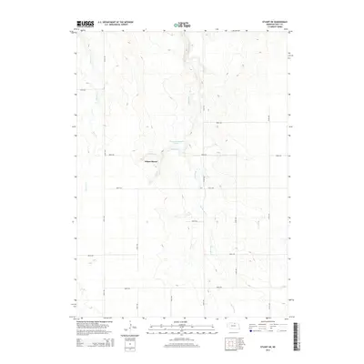
2014 Map of Stuart NE
USGS Topo · Published 2014About this map
Wilson Ranch sits at the heart of this Holt County landscape, positioned near the headwaters of Conway Br and Springs Cr. The terrain is defined by the intricate drainage systems of Big Sandy Cr and Beaver Cr, which carve through the Nebraska sandhills. Water management is a visible priority in this ranching country, evidenced by the presence of McEachén Reservoir Number 1. A rigid grid of county roads, such as 888th Rd and 472nd Ave, provides access across the undulating topography, reflecting the organized division of land in the early 21st century. This map captures the intersection of traditional cattle ranching and modern water resource infrastructure in a sparsely populated section of the Great Plains.
Find a feature on this map
19 named features on this map. Tap any name to fly to it.
Don’t see what you’re looking for? This feature index may not catch every label — zoom into the map to look around manually.
Map Details
Editions of this 2014 Stuart NE Map
This is the sole edition of this map. No revisions or reprints were ever made.
Other maps of this area
1951 · Butte SW
USGS Topo · 1:24,000
1951 · Dustin
USGS Topo · 1:24,000
1951 · Naper SW
USGS Topo · 1:24,000
1954 · Stuart
USGS Topo · 1:24,000
1954 · Atkinson
USGS Topo · 1:24,000
1954 · Stuart SE
USGS Topo · 1:24,000
1954 · Stuart NW
USGS Topo · 1:24,000
1954 · Atkinson NW
USGS Topo · 1:24,000
1954 · Stuart NE
USGS Topo · 1:24,000
1955 · O'Neill
USGS Topo · 1:250,000