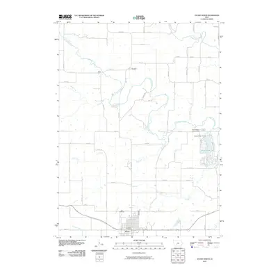
2010 Map of Stuart North
USGS Topo · Published 2010About this map
Stuart anchors the southern portion of this landscape, featuring the Stuart Post Office and the Stuart Speedway as focal points for the community. The town sits at a crossroads of transport and commerce, while the northern terrain is defined by the winding course of the South Raccoon River. This waterway meanders past the settlement of Dale and the Morrisburg Cemetery, which serves as a significant marker for local genealogical research. To the east, the Diamondhead Lake development introduces a distinctive recreational geography, complete with the Diamondhead Lake Dam and a dedicated Diamondhead Landing Strip. Numerous tributaries including Beaver Creek, Deer Creek, and Long Branch dissect the agrarian parcels, illustrating the drainage patterns that have shaped land use and property boundaries throughout the region.
Find a feature on this map
59 named features on this map. Tap any name to fly to it.
Don’t see what you’re looking for? This feature index may not catch every label — zoom into the map to look around manually.
Map Details
Editions of this 2010 Stuart North Map
This is the sole edition of this map. No revisions or reprints were ever made.
Other maps of this area

1949 · Adel
USGS Topo · 1:62,500

1951 · Adel
USGS Topo · 1:62,500

1952 · Panora
USGS Topo · 1:62,500

1952 · Winterset
USGS Topo · 1:62,500

1954 · Greenfield
USGS Topo · 1:62,500

1954 · Omaha
USGS Topo · 1:250,000

1957 · Omaha
USGS Topo · 1:250,000

1958 · Omaha
USGS Topo · 1:250,000

1982 · Guthrie Center East
USGS Topo · 1:24,000

1982 · Panora
USGS Topo · 1:24,000