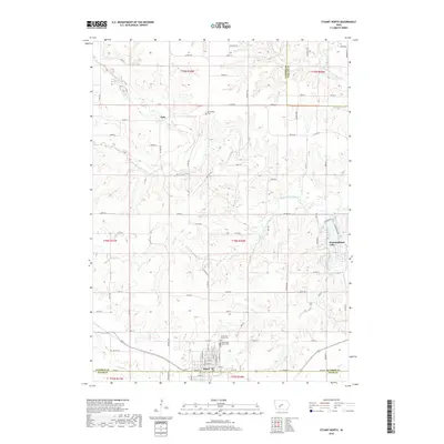
2018 Map of Stuart North
USGS Topo · Published 2018About this map
The South Raccoon River and Middle Raccoon River carve through this section of the Iowan landscape, shaping the development of the region's early settlements. To the north, the small community of Dale sits near the riverbanks, while the historical Morrisburg Cem stands as a quiet marker of local genealogy. The southern portion of the map is anchored by the residential grid of Stuart, which spans the boundary between Guthrie and Adair counties.
Find a feature on this map
84 named features on this map. Tap any name to fly to it.
Don’t see what you’re looking for? This feature index may not catch every label — zoom into the map to look around manually.
Map Details
Editions of this 2018 Stuart North Map
This is the sole edition of this map. No revisions or reprints were ever made.
Other maps of this area

1949 · Adel
USGS Topo · 1:62,500

1951 · Adel
USGS Topo · 1:62,500

1952 · Panora
USGS Topo · 1:62,500

1952 · Winterset
USGS Topo · 1:62,500

1954 · Greenfield
USGS Topo · 1:62,500

1954 · Omaha
USGS Topo · 1:250,000

1957 · Omaha
USGS Topo · 1:250,000

1958 · Omaha
USGS Topo · 1:250,000

1982 · Guthrie Center East
USGS Topo · 1:24,000

1982 · Panora
USGS Topo · 1:24,000