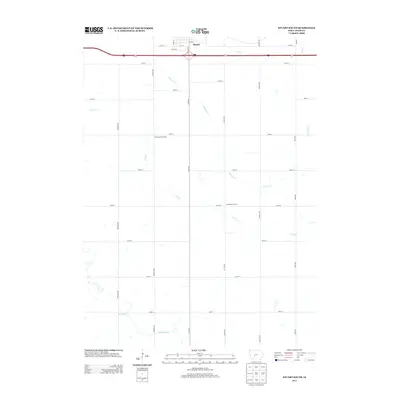
2013 Map of Stuart South
USGS Topo · Published 2013About this map
Stuart anchors the northern edge of this landscape, where the street grid of the southern town limits transitions into the expansive agricultural terrain of Adair County. The map reveals a rural structure defined by a systematic grid of roads like Trenton Ave and Sheldon Ave, which partition the drainage basins of several wandering waterways. These drainage systems, including the Middle River, N River, and Plunger Cr, dictate the movement of the terrain across the section lines. Two rural institutions, the Prairie Queen School and North River School, are positioned along these country roads, marking traditional community centers that served the surrounding farmstead families. The layout of these schools relative to the water branches provides a clear view of the historical settlement patterns that prioritized central access within this rolling prairie environment.
Find a feature on this map
31 named features on this map. Tap any name to fly to it.
Don’t see what you’re looking for? This feature index may not catch every label — zoom into the map to look around manually.
Map Details
Editions of this 2013 Stuart South Map
This is the sole edition of this map. No revisions or reprints were ever made.
Other maps of this area

1949 · Adel
USGS Topo · 1:62,500

1951 · Adel
USGS Topo · 1:62,500

1952 · Panora
USGS Topo · 1:62,500

1952 · Winterset
USGS Topo · 1:62,500

1954 · Greenfield
USGS Topo · 1:62,500

1954 · Omaha
USGS Topo · 1:250,000

1957 · Omaha
USGS Topo · 1:250,000

1958 · Omaha
USGS Topo · 1:250,000
1982 · Redfield
USGS Topo · 1:24,000
1982 · Stuart North
USGS Topo · 1:24,000