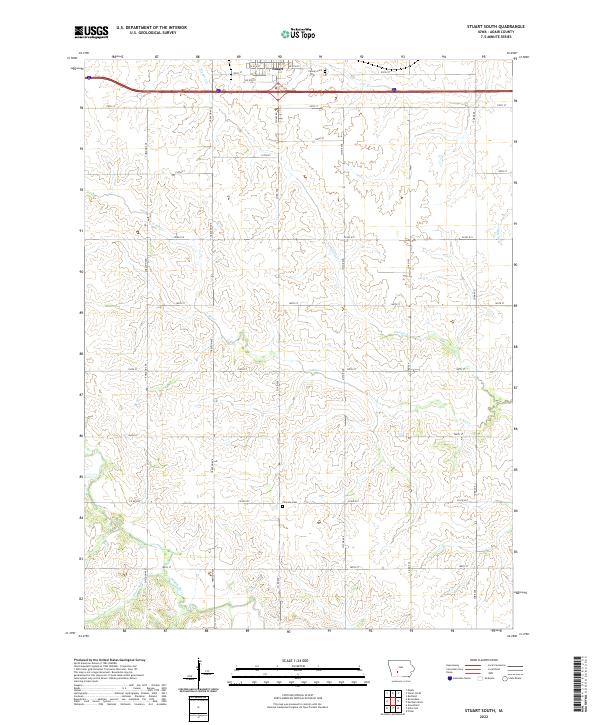
2022 Map of Stuart South
USGS Topo · Published 2022About this map
The town of Stuart anchors the northern edge of this landscape, where the street grid of SW 6th St and SE 6th St gives way to the section-line roads of rural Adair County. This area is defined by the headwaters and drainage basins of several significant Iowa waterways, including the winding course of the Middle River and the N River. These river systems, along with tributaries like Plunger Cr and Bruce Br, carve a rolling topography through the agricultural land south of the interstate corridor.
Find a feature on this map
33 named features on this map. Tap any name to fly to it.
Don’t see what you’re looking for? This feature index may not catch every label — zoom into the map to look around manually.
Map Details
Editions of this 2022 Stuart South Map
This is the sole edition of this map. No revisions or reprints were ever made.
Other maps of this area

1949 · Adel
USGS Topo · 1:62,500

1951 · Adel
USGS Topo · 1:62,500

1952 · Panora
USGS Topo · 1:62,500

1952 · Winterset
USGS Topo · 1:62,500

1954 · Greenfield
USGS Topo · 1:62,500

1954 · Omaha
USGS Topo · 1:250,000

1957 · Omaha
USGS Topo · 1:250,000

1958 · Omaha
USGS Topo · 1:250,000
1982 · Redfield
USGS Topo · 1:24,000
1982 · Stuart North
USGS Topo · 1:24,000