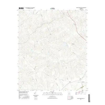
2017 Map of Stuckey Boone Lake
USGS Topo · Published 2017About this map
Cooktown lies at the convergence of several local thoroughfares in this modern era survey of the Georgia interior, marking the border between Wilkinson and Laurens counties. The landscape is defined by its numerous family and community burial grounds, including the Wesley, Walnut Creek, and Thomas Dupree cemeteries, which offer valuable data points for genealogical research in this rural corridor. A network of minor waterways, such as Maiden Creek and Cedar Creek, winds through the undulating terrain, punctuated by named water bodies like Stuckey Boone Lake and Halls Lake. The road system, characterized by long-established routes like Old Macon Road and Quinn Williams Road, reflects a pattern of rural settlement and land use that connects these dispersed community centers and historic family landmarks across the county line.
Find a feature on this map
46 named features on this map. Tap any name to fly to it.
Don’t see what you’re looking for? This feature index may not catch every label — zoom into the map to look around manually.
Map Details
Editions of this 2017 Stuckey Boone Lake Map
This is the sole edition of this map. No revisions or reprints were ever made.
Other maps of this area

1916 · Irwinton
USGS Topo · 1:62,500

1920 · Irwinton
USGS Topo · 1:62,500

1956 · Gordon
USGS Topo · 1:62,500

1956 · Jeffersonville
USGS Topo · 1:62,500

1957 · Macon
USGS Topo · 1:250,000

1958 · Macon
USGS Topo · 1:250,000

1964 · Macon
USGS Topo · 1:250,000

1973 · Massey Hill
USGS Topo · 1:24,000
1973 · Irwinton
USGS Topo · 1:24,000
1973 · Toomsboro
USGS Topo · 1:24,000