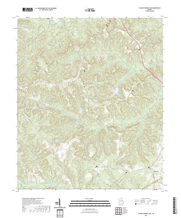
2024 Map of Stuckey Boone Lake
USGS Topo · Published 2024About this map
Cooktown lies at the crossroads of the southeastern corner of this Wilkinson County landscape, where the local boundary meets the Wilkinson and Laurens county line. The terrain is defined by a dense network of tributaries including Cedar Creek, Walnut Creek, and Maiden Creek, which carve through the wooded hills. For genealogists and local historians, the sheet is notably dense with small family and community burial grounds. These sites, such as Red Level Cem, Leona Payne Cem, and Thomas Dupree Cem, are scattered along rural routes like Old Macon Rd and Stuckey Rd. The presence of Halls Lake and Knights Pond further illustrates the hydrology of this rural Georgia district, where the settlement pattern remains tied to high ground above the many creek branches.
Find a feature on this map
43 named features on this map. Tap any name to fly to it.
Don’t see what you’re looking for? This feature index may not catch every label — zoom into the map to look around manually.
Map Details
Editions of this 2024 Stuckey Boone Lake Map
This is the sole edition of this map. No revisions or reprints were ever made.
Other maps of this area

1916 · Irwinton
USGS Topo · 1:62,500

1920 · Irwinton
USGS Topo · 1:62,500

1956 · Gordon
USGS Topo · 1:62,500

1956 · Jeffersonville
USGS Topo · 1:62,500

1957 · Macon
USGS Topo · 1:250,000

1958 · Macon
USGS Topo · 1:250,000

1964 · Macon
USGS Topo · 1:250,000

1973 · Massey Hill
USGS Topo · 1:24,000
1973 · Irwinton
USGS Topo · 1:24,000
1973 · Toomsboro
USGS Topo · 1:24,000