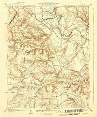
1938 Map of Studley
USGS Topo · Published 1938About this map
The Pamunkey River winds through the northern portion of this landscape, defining the dramatic loops of Sutton Neck and Crump Neck. This mid-1930s survey of Hanover County reveals a network of small rural communities and local institutions centered around prominent crossroads. Religious and educational life is well-documented through numerous sites such as Bethesda Ch, Enon Ch, and School No 5, while the presence of an Airway Beacon near Pole Green marks the early modernization of the regional infrastructure. The terrain is deeply carved by the Totopotomoy Creek and Crump Creek systems, which create a complex series of ridges and ravines that dictated the placement of historic thoroughfares like Ashcake Road and Gold Road. Small settlements such as Rural Point, Pollard, and Linney Corners anchor the interior, showing the established settlement patterns before significant suburban expansion reached this part of Virginia.
Find a feature on this map
45 named features on this map. Tap any name to fly to it.
Don’t see what you’re looking for? This feature index may not catch every label — zoom into the map to look around manually.
Map Details
Editions of this 1938 Studley Map
3 editions found
Other maps of this area

1894 · Richmond
USGS Topo · 1:62,500

1895 · Richmond
USGS Topo · 1:62,500

1918 · Doswell
USGS Topo · 1:62,500

1918 · Aylett
USGS Topo · 1:62,500

1920 · King William
USGS Topo · 1:62,500

1933 · Aylett
USGS Topo · 1:62,500

1934 · Seven Pines
USGS Topo · 1:24,000

1934 · Richmond
USGS Topo · 1:24,000

1938 · Seven Pines
USGS Topo · 1:31,680

1938 · Studley
USGS Topo · 1:31,680