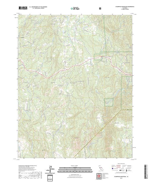
2023 Map of Stumpfield Mountain
USGS Topo · Published 2023About this map
Bootjack and the winding reaches of the Middle Fork Chowchilla River anchor this 2023 survey of the California foothills. The landscape is defined by the convergence of the West Fork Chowchilla River and the East Fork Chowchilla River, a hydrological network that shaped the early settlement patterns of Mariposa County. High ground is marked by prominent peaks such as Stumpfield Mtn and Indian Peak, while the northern portion of the map transitions into the Sierra National Forest. Local infrastructure like the Usona Fire Station and the rural network of Triangle Rd and Usona Rd provide a clear view of modern land use in a region historically dominated by timber and ranching. Genealogists can trace family-named landmarks such as Magoon Hill and Butler Mtn, alongside the secluded Nelson Cove.
Find a feature on this map
100 named features on this map. Tap any name to fly to it.
Don’t see what you’re looking for? This feature index may not catch every label — zoom into the map to look around manually.
Map Details
Editions of this 2023 Stumpfield Mountain Map
This is the sole edition of this map. No revisions or reprints were ever made.
Other maps of this area

1897 · Yosemite
USGS Topo · 1:125,000

1900 · Yosemite
USGS Topo · 1:125,000

1903 · Yosemite
USGS Topo · 1:125,000

1909 · Yosemite
USGS Topo · 1:125,000

1912 · Mariposa
USGS Topo · 1:125,000

1947 · Mariposa
USGS Topo · 1:24,000

1947 · Mariposa
USGS Topo · 1:250,000

1947 · El Portal
USGS Topo · 1:62,500

1947 · Mariposa
USGS Topo · 1:62,500

1947 · Buckingham Mtn
USGS Topo · 1:24,000