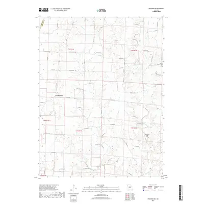
2017 Map of Sturgeon SW
USGS Topo · Published 2017About this map
Woodlandville serves as the central settlement in this rural expanse on the border of Howard and Boone counties. The landscape is defined by the dendritic drainage patterns of Perche Creek and Callahan Creek, which carve through the terrain and dictate the placement of the local road network. Rural life is anchored by landmarks such as Hatton Chapel and the White Cloud Flying Field, while the region's deeper history is preserved in family and community burial grounds like Dripping Spring Cemetery and Botner Cemetery.
Find a feature on this map
78 named features on this map. Tap any name to fly to it.
Don’t see what you’re looking for? This feature index may not catch every label — zoom into the map to look around manually.
Map Details
Editions of this 2017 Sturgeon SW Map
This is the sole edition of this map. No revisions or reprints were ever made.
Other maps of this area

1886 · Jefferson City
USGS Topo · 1:125,000

1888 · Boonville
USGS Topo · 1:125,000

1890 · Moberly
USGS Topo · 1:125,000

1890 · Glasgow
USGS Topo · 1:125,000

1894 · Jefferson City
USGS Topo · 1:125,000

1917 · Sturgeon
USGS Topo · 1:62,500

1935 · Columbia
USGS Topo · 1:24,000

1940 · Columbia
USGS Topo · 1:24,000

1947 · Jefferson City
USGS Topo · 1:250,000
1948 · Columbia
USGS Topo · 1:24,000