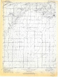
1971 Map of Sturgis SE
USGS Topo · Published 1973About this map
Cimarron Co and Texas Co meet in this 1971 survey of the Oklahoma Panhandle, where the industrial footprint of the energy sector is etched across the High Plains. The landscape is defined by the widespread distribution of Gas Wells, Oil Wells, and specialized areas like the Carthage Field. These industrial features are interspersed with topographic landmarks such as Sandy Hook, Willow Bar, and Turney.
Find a feature on this map
14 named features on this map. Tap any name to fly to it.
Don’t see what you’re looking for? This feature index may not catch every label — zoom into the map to look around manually.
Map Details
Editions of this 1971 Sturgis SE Map
2 editions found
Other maps of this area

1954 · Perryton
USGS Topo · 1:250,000

1954 · Dalhart
USGS Topo · 1:250,000

1958 · Perryton
USGS Topo · 1:250,000

1958 · Dalhart
USGS Topo · 1:250,000

1962 · Dalhart
USGS Topo · 1:250,000

1971 · Griggs NE
USGS Topo · 1:24,000

1971 · Sturgis
USGS Topo · 1:24,000

1971 · Hopkins
USGS Topo · 1:24,000

1971 · Keyes East
USGS Topo · 1:24,000

1971 · Griggs NW
USGS Topo · 1:24,000