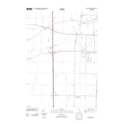
2013 Map of Sturtevant
USGS Topo · Published 2013About this map
Sturtevant and the industrial corridor of Waxdale anchor the eastern side of this Racine County landscape, where the agricultural past meets modern logistics. The map documents a transition from the quiet crossroads at Ives Grove and Sylvania to the expanding commercial developments along the Interstate 41 corridor. Waterways like the East Br Root River Canal and Hoods Cr reflect the drainage patterns of this fertile prairie region, while the Pike River winds through the northern section. This 2013 survey shows the distinct layout of local family-named roads such as Borgardt Rd and N Fancher Rd, alongside specialized landmarks like Sylvania Airport and the recreational expanse of Ives Grove Golf Links. In the south, the village of Somers begins to appear, showing the suburban progression between Racine and Kenosha.
Find a feature on this map
68 named features on this map. Tap any name to fly to it.
Don’t see what you’re looking for? This feature index may not catch every label — zoom into the map to look around manually.
Map Details
Editions of this 2013 Sturtevant Map
This is the sole edition of this map. No revisions or reprints were ever made.
Other maps of this area

1891 · Bayview
USGS Topo · 1:62,500

1891 · Muskego
USGS Topo · 1:62,500

1892 · Racine
USGS Topo · 1:62,500

1893 · Silver Lake
USGS Topo · 1:62,500

1901 · Bayview
USGS Topo · 1:62,500

1901 · Muskego
USGS Topo · 1:62,500

1905 · Racine
USGS Topo · 1:62,500

1906 · Silver Lake
USGS Topo · 1:62,500

1954 · Rockford
USGS Topo · 1:250,000

1955 · Rockford
USGS Topo · 1:250,000