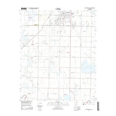
2014 Map of Stuttgart South
USGS Topo · Published 2014About this map
Stuttgart's southern grid and the surrounding agricultural landscapes of Arkansas and Prairie Counties are detailed here in the early 21st century. The map illustrates a transition from the urban streets of South Stuttgart and Ricusky into a vast network of irrigation and water management essential to the Grand Prairie's rice and soybean farming. Notable water features like the Tindall Reservoir, Tindall Lake, and McDoogle Reservoir punctuate the flat terrain, alongside winding natural drainages such as Bayou Meto and Elm Prong Mill Bayou. Local history and genealogy are anchored by several burial grounds, including the Holy Rosary Cem, Lone Tree Cem, and Sunshine Cem. The small settlement of Goldman stands west of the city, connected by the Goldman Loop and a network of named country roads that trace the section lines of the Public Land Survey System.
Find a feature on this map
119 named features on this map. Tap any name to fly to it.
Don’t see what you’re looking for? This feature index may not catch every label — zoom into the map to look around manually.
Map Details
Editions of this 2014 Stuttgart South Map
This is the sole edition of this map. No revisions or reprints were ever made.
Other maps of this area

1935 · Clarendon
USGS Topo · 1:62,500

1937 · Stuttgart
USGS Topo · 1:62,500

1939 · Stuttgart
USGS Topo · 1:62,500

1941 · De Witt
USGS Topo · 1:62,500

1941 · Goldman
USGS Topo · 1:62,500

1941 · Clarendon
USGS Topo · 1:62,500

1948 · Helena
USGS Topo · 1:250,000

1950 · Helena
USGS Topo · 1:250,000

1954 · De Witt
USGS Topo · 1:62,500

1955 · Helena
USGS Topo · 1:250,000