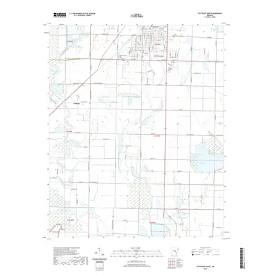
2020 Map of Stuttgart South
USGS Topo · Published 2020About this map
Stuttgart stands as the primary urban center in this 2020 landscape, where the grid of the city meets the vast agricultural plains of the Grand Prairie. The southern portion of the city is detailed here, featuring the Arkansas County Circuit Court, Phillips Community College, and residential developments along Oliver St and W 22nd St. To the west, the settlement of Goldman remains a distinct point of interest along the route toward Bayou Meto, which winds through the western portion of the quadrangle. The region's dependence on water management for agriculture is evident in the numerous irrigation features and large-scale water bodies like Tindall Reservoir and Daugherty Reservoir. Genealogists will find several burial grounds of note, including Lone Tree Cem on the outskirts of the city and the more remote Sunshine Cem.
Find a feature on this map
64 named features on this map. Tap any name to fly to it.
Don’t see what you’re looking for? This feature index may not catch every label — zoom into the map to look around manually.
Map Details
Editions of this 2020 Stuttgart South Map
This is the sole edition of this map. No revisions or reprints were ever made.
Other maps of this area

1935 · Clarendon
USGS Topo · 1:62,500

1937 · Stuttgart
USGS Topo · 1:62,500

1939 · Stuttgart
USGS Topo · 1:62,500

1941 · De Witt
USGS Topo · 1:62,500

1941 · Goldman
USGS Topo · 1:62,500

1941 · Clarendon
USGS Topo · 1:62,500

1948 · Helena
USGS Topo · 1:250,000

1950 · Helena
USGS Topo · 1:250,000

1954 · De Witt
USGS Topo · 1:62,500

1955 · Helena
USGS Topo · 1:250,000