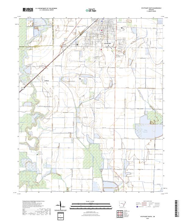
2024 Map of Stuttgart South
USGS Topo · Published 2024About this map
Agricultural lands of the Grand Prairie dominate the landscape south of Stuttgart, where the irrigation needs of Arkansas rice country are visible in the large-scale water management systems of Tindall Reservoir and Daugherty Reservoir. The grid-patterned streets of the city transition into expansive fields, punctuated by small rural communities like Goldman. Local history is anchored by several long-standing burial grounds, including Lone Tree Cem, Young Island Cem, and Sunshine Cem, providing vital reference points for genealogists. Educational infrastructure is represented by Phillips Community College, while the natural drainage of the region remains defined by the winding course of Bayou Meto and Elm Prong Mill Bayou. This topography reflects the intensive hydrological engineering required to support the local economy while managing the low-lying prairie terrain.
Find a feature on this map
114 named features on this map. Tap any name to fly to it.
Don’t see what you’re looking for? This feature index may not catch every label — zoom into the map to look around manually.
Map Details
Editions of this 2024 Stuttgart South Map
This is the sole edition of this map. No revisions or reprints were ever made.
Other maps of this area

1935 · Clarendon
USGS Topo · 1:62,500

1937 · Stuttgart
USGS Topo · 1:62,500

1939 · Stuttgart
USGS Topo · 1:62,500

1941 · De Witt
USGS Topo · 1:62,500

1941 · Goldman
USGS Topo · 1:62,500

1941 · Clarendon
USGS Topo · 1:62,500

1948 · Helena
USGS Topo · 1:250,000

1950 · Helena
USGS Topo · 1:250,000

1954 · De Witt
USGS Topo · 1:62,500

1955 · Helena
USGS Topo · 1:250,000