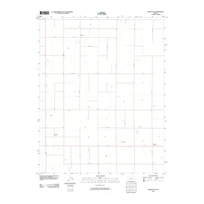
2010 Map of Sublette SE
USGS Topo · Published 2010About this map
Banner Cemetery and the rural landscape of Seward County characterize this high-plains region during the early 21st century. The map reveals a highly structured agricultural grid, where long straight thoroughfares like 22 Mile Rd and Cotton Rd define the section lines of the Kansas prairie. This layout reflects the enduring influence of the Public Land Survey System on the modern landscape, where transportation and land use remain strictly aligned with cardinal directions.
Find a feature on this map
17 named features on this map. Tap any name to fly to it.
Don’t see what you’re looking for? This feature index may not catch every label — zoom into the map to look around manually.
Map Details
Editions of this 2010 Sublette SE Map
This is the sole edition of this map. No revisions or reprints were ever made.
Other maps of this area

1955 · Dodge City
USGS Topo · 1:250,000

1958 · Dodge City
USGS Topo · 1:250,000

1959 · Dodge City
USGS Topo · 1:250,000

1968 · Plains SW
USGS Topo · 1:24,000

1968 · Sublette SW
USGS Topo · 1:24,000

1968 · Plains NW
USGS Topo · 1:24,000
1968 · Satanta
USGS Topo · 1:24,000

1968 · Liberal NE
USGS Topo · 1:24,000

1968 · Sublette SE
USGS Topo · 1:24,000

1968 · Liberal NW
USGS Topo · 1:24,000