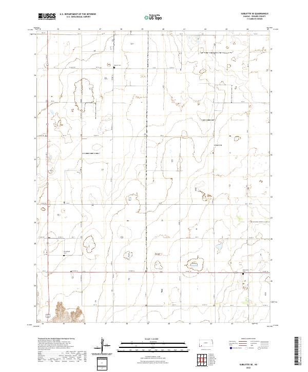
2022 Map of Sublette SE
USGS Topo · Published 2022About this map
Seward County’s rural character is defined by a rigorous grid of section lines and gravel paths, where the High Plains landscape is punctuated only by occasional clusters of trees and remote burial grounds. The agricultural order of the region is mapped through named thoroughfares like Cotton Rd and Road N, which link the vast acreage of township divisions such as t31s r32w and t32s r33w. For genealogists and local historians, several landmarks provide vital links to the area's pioneer heritage, including Banner Cem in the north and the Mennonite Cem to the southeast. Near the western edge of the quadrangle, Springfield Cem sits as a quiet marker of a community within this expansive prairie territory. The naming convention of the lateral roads, such as 22 Mile Rd and 17 Mile Rd, reflects the methodical surveying used to organize this portion of southwest Kansas.
Find a feature on this map
33 named features on this map. Tap any name to fly to it.
Don’t see what you’re looking for? This feature index may not catch every label — zoom into the map to look around manually.
Map Details
Editions of this 2022 Sublette SE Map
This is the sole edition of this map. No revisions or reprints were ever made.
Other maps of this area

1955 · Dodge City
USGS Topo · 1:250,000

1958 · Dodge City
USGS Topo · 1:250,000

1959 · Dodge City
USGS Topo · 1:250,000

1968 · Plains SW
USGS Topo · 1:24,000

1968 · Sublette SW
USGS Topo · 1:24,000

1968 · Plains NW
USGS Topo · 1:24,000
1968 · Satanta
USGS Topo · 1:24,000

1968 · Liberal NE
USGS Topo · 1:24,000

1968 · Sublette SE
USGS Topo · 1:24,000

1968 · Liberal NW
USGS Topo · 1:24,000