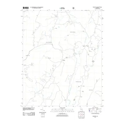
2011 Map of Subligna
USGS Topo · Published 2011About this map
West Armuchee Valley and East Armuchee Valley define the landscape of this region in Northwest Georgia, where small communities are tucked between prominent ridges. The settlement of Subligna sits centrally, anchored by local history markers like the Subligna Cemetery. The drainage patterns of West Armuchee Creek and East Armuchee Creek have historically guided the placement of homesteads and small hamlets such as Beatum and New.
Find a feature on this map
27 named features on this map. Tap any name to fly to it.
Don’t see what you’re looking for? This feature index may not catch every label — zoom into the map to look around manually.
Map Details
Editions of this 2011 Subligna Map
This is the sole edition of this map. No revisions or reprints were ever made.
Other maps of this area

1886 · Ringgold
USGS Topo · 1:125,000

1886 · Rome
USGS Topo · 1:125,000

1892 · Ringgold
USGS Topo · 1:125,000

1898 · Rome
USGS Topo · 1:125,000

1899 · Rome
USGS Topo · 1:125,000

1904 · Rome
USGS Topo · 1:125,000

1935 · Catlett
USGS Topo · 1:24,000

1935 · Villanow
USGS Topo · 1:24,000

1936 · Estelle
USGS Topo · 1:24,000
1946 · Estelle
USGS Topo · 1:24,000