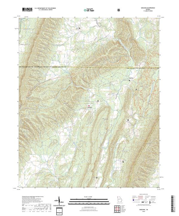
2024 Map of Subligna
USGS Topo · Published 2024About this map
Subligna serves as a quiet focal point in a landscape defined by the parallel ridges of northwest Georgia. This modern survey illustrates the persistent rural character of the area, where the Chattahoochee National Forest encompasses much of the high ground on Strawberry Mtn and Johns Mtn. The map reveals a high concentration of small family and community burial grounds, such as Salmon Cem, Mount Joy Cem, and Mills Cem, which are vital markers for genealogists tracing the legacy of families in the West Armuchee Valley.
Find a feature on this map
46 named features on this map. Tap any name to fly to it.
Don’t see what you’re looking for? This feature index may not catch every label — zoom into the map to look around manually.
Map Details
Editions of this 2024 Subligna Map
This is the sole edition of this map. No revisions or reprints were ever made.
Other maps of this area

1886 · Ringgold
USGS Topo · 1:125,000

1886 · Rome
USGS Topo · 1:125,000

1892 · Ringgold
USGS Topo · 1:125,000

1898 · Rome
USGS Topo · 1:125,000

1899 · Rome
USGS Topo · 1:125,000

1904 · Rome
USGS Topo · 1:125,000

1935 · Catlett
USGS Topo · 1:24,000

1935 · Villanow
USGS Topo · 1:24,000

1936 · Estelle
USGS Topo · 1:24,000
1946 · Estelle
USGS Topo · 1:24,000