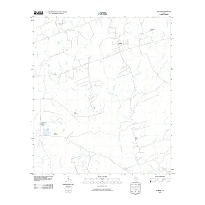
2010 Map of Sublime
USGS Topo · Published 2010About this map
The Navidad River and its intricate network of tributaries dominate the landscape of central Lavaca County. This rural terrain is anchored by several long-established crossroads communities, including Sublime, Vsetin, and Vienna, which represent the agricultural heart of the region. The map provides significant value for genealogical research, documenting numerous burial grounds such as Smoothingiron Cemetery, Fuller Cemetery, and the Pagel Settlement Cemetery. The drainage patterns are notably complex, featuring uniquely named watercourses like Cat Thicket Branch, Smoothingiron Branch, and Laughlins Sandy Creek. Infrastructure in the area is defined by a mix of state highways and an extensive system of county roads, such as Hickory Ridge Rd, that follow the meandering paths of Sandies Creek and Willow Creek. This 2010 survey illustrates the persistent rural character of the Texas coastal plains, where small settlements and family landmarks like the Barnes Lake Dam endure amid the watershed's natural contours.
Find a feature on this map
40 named features on this map. Tap any name to fly to it.
Don’t see what you’re looking for? This feature index may not catch every label — zoom into the map to look around manually.
Map Details
Editions of this 2010 Sublime Map
This is the sole edition of this map. No revisions or reprints were ever made.
Other maps of this area

1919 · Schulenburg
USGS Topo · 1:62,500

1953 · Seguin
USGS Topo · 1:250,000

1956 · Glidden
USGS Topo · 1:62,500

1958 · Seguin
USGS Topo · 1:250,000

1962 · Sublime
USGS Topo · 1:24,000

1962 · Hallettsville SE
USGS Topo · 1:24,000

1962 · Hallettsville
USGS Topo · 1:24,000

1964 · Speaks
USGS Topo · 1:24,000

1964 · Ezzell
USGS Topo · 1:24,000

1965 · Oakland
USGS Topo · 1:24,000