
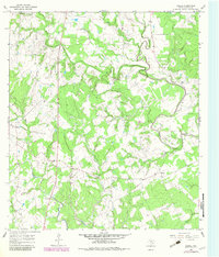
1964 Map of Ezzell
USGS Topo · Published 1967About this map
Koerth and Ezzell anchor this mid-1960s landscape in Lavaca County, where the meandering course of the Lavaca River and its unique loop at Tiger Bend River define the local topography. This rural Texas terrain is etched with a dense network of seasonal and permanent waterways, including Mustang Creek, Rocky Creek, and Clarks Creek, which historically dictated the placement of early infrastructure. Local community life is evidenced by Mossy Grove Ch, Salem Ch, and Providence Sch, reflecting the importance of rural social centers during this era.
Find a feature on this map
22 named features on this map. Tap any name to fly to it.
Don’t see what you’re looking for? This feature index may not catch every label — zoom into the map to look around manually.
Map Details
Editions of this 1964 Ezzell Map
2 editions found
Other maps of this area

1953 · Seguin
USGS Topo · 1:250,000

1958 · Seguin
USGS Topo · 1:250,000

1962 · Terryville
USGS Topo · 1:24,000

1962 · Sublime
USGS Topo · 1:24,000

1962 · Hallettsville SE
USGS Topo · 1:24,000

1962 · Hallettsville
USGS Topo · 1:24,000

1963 · Sweet Home
USGS Topo · 1:24,000

1964 · Morales
USGS Topo · 1:24,000

1965 · Wied
USGS Topo · 1:24,000

1965 · Hope
USGS Topo · 1:24,000