
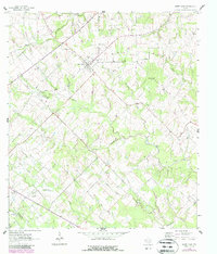
1963 Map of Sweet Home
USGS Topo · Published 1964About this map
The community of Sweet Home serves as the focal point for this rural landscape in the early 1960s, situated near the boundary line of Lavaca Co De Witt Co. The area is characterized by a high density of rural burial sites, including the Queen of Peace Cem, Sweet Home Cem, and Yellow Bank Cem, which offer significant value for genealogical research. The terrain is crisscrossed by numerous waterways such as Clarks Creek and Supplejack Creek, while the presence of the South Yoakum Oilfield and various Gas Wells in the southwest corner points to the region's energy-based economy. Historical transportation routes are evidenced by the Old Railroad Grade, which parallels the main road through the center of the township. Local gathering points and infrastructure like the Picnic Ground and the Radio Tower (KKDI) further ground the map in its mid-century Texas context.
Find a feature on this map
27 named features on this map. Tap any name to fly to it.
Don’t see what you’re looking for? This feature index may not catch every label — zoom into the map to look around manually.
Map Details
Editions of this 1963 Sweet Home Map
2 editions found
Other maps of this area

1953 · Seguin
USGS Topo · 1:250,000

1958 · Seguin
USGS Topo · 1:250,000

1962 · Edgar
USGS Topo · 1:24,000

1962 · Terryville
USGS Topo · 1:24,000

1962 · Hallettsville
USGS Topo · 1:24,000

1963 · Yoakum
USGS Topo · 1:24,000

1964 · Ezzell
USGS Topo · 1:24,000

1965 · Wied
USGS Topo · 1:24,000

1965 · Hope
USGS Topo · 1:24,000
1965 · Shiner
USGS Topo · 1:24,000