
1962 Map of Terryville
USGS Topo · Published 1964About this map
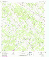
Terryville sits at the heart of this early 1960s rural landscape, straddling the border between Lavaca Co and De Witt Co. The area is defined by a dense network of waterways, including the winding Big Brushy Creek and Tongua Creek, which carved out a topography marked by numerous small cemeteries and family landmarks like the Cook-Holland Cem and County Line Cem. The presence of the Brushy Creek Oil Field and various Gas Wells indicates an economy transitioning from traditional ranching and agriculture toward mineral extraction.
Find a feature on this map
24 named features on this map. Tap any name to fly to it.
Don’t see what you’re looking for? This feature index may not catch every label — zoom into the map to look around manually.
Map Details
Editions of this 1962 Terryville Map
2 editions found
Other maps of this area

1953 · Seguin
USGS Topo · 1:250,000

1958 · Seguin
USGS Topo · 1:250,000

1962 · Verhelle
USGS Topo · 1:24,000

1962 · Edgar
USGS Topo · 1:24,000

1963 · Yoakum
USGS Topo · 1:24,000

1963 · Fordtran
USGS Topo · 1:24,000

1963 · Sweet Home
USGS Topo · 1:24,000

1964 · Ezzell
USGS Topo · 1:24,000

1965 · Hope
USGS Topo · 1:24,000
1966 · Peck Branch
USGS Topo · 1:24,000