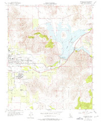
1956 Map of Success Dam
USGS Topo · Published 1975About this map
Lake Success dominates the center of this mid-century landscape, a reservoir formed where the Tule River and South Tule River converge. To the west, the expansion of Porterville is evident, showing residential street grids like Morton St and Poplar Ave alongside major local institutions such as the Porterville State Hospital. The map records an era when traditional agriculture and water management defined Tulare County, with numerous gaging stations and a network of ditches feeding the surrounding valley.
Find a feature on this map
36 named features on this map. Tap any name to fly to it.
Don’t see what you’re looking for? This feature index may not catch every label — zoom into the map to look around manually.
Map Details
Editions of this 1956 Success Dam Map
4 editions found
Other maps of this area

1904 · Kaweah
USGS Topo · 1:125,000

1909 · Kaweah
USGS Topo · 1:125,000

1928 · Lindsay
USGS Topo · 1:31,680

1929 · Porterville
USGS Topo · 1:31,680

1929 · Ducor
USGS Topo · 1:31,680

1936 · White River
USGS Topo · 1:62,500

1936 · Tobias Peak
USGS Topo · 1:125,000

1937 · Kaweah
USGS Topo · 1:125,000
1942 · Porterville
USGS Topo · 1:62,500
1942 · Terra Bella
USGS Topo · 1:62,500