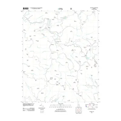
2011 Map of Suches
USGS Topo · Published 2011About this map
Mount Airy Cemetery and several other family and community burial grounds, such as Cavender Cemetery and Mount Lebanon Cemetery, sit atop the ridges and valley floors of this portion of northern Georgia. The landscape is defined by its numerous gaps and mountains, including Hogback Mountain and Black Mountain, where a Black Mountain Look Out Tower overlooks the terrain. Small settlements like Suches and Gaddistown are connected by a network of rural routes, including Gaddistown Rd and Camp Wahsega Rd. The drainage pattern is complex, with headwaters of the Etowah River and Toccoa River carving through the highlands alongside smaller streams like Canada Creek and Suches Creek. Unique local identifiers such as Devils Kitchen and the Gooch Gap Trail Shelter provide specific points of interest for those studying the social and physical geography of this mountain region.
Find a feature on this map
138 named features on this map. Tap any name to fly to it.
Don’t see what you’re looking for? This feature index may not catch every label — zoom into the map to look around manually.
Map Details
Editions of this 2011 Suches Map
This is the sole edition of this map. No revisions or reprints were ever made.
Other maps of this area

1886 · Dahlonega
USGS Topo · 1:125,000

1888 · Ellijay
USGS Topo · 1:125,000

1892 · Dahlonega
USGS Topo · 1:125,000

1892 · Ellijay
USGS Topo · 1:125,000

1896 · Dahlonega
USGS Topo · 1:125,000

1898 · Ellijay
USGS Topo · 1:125,000

1903 · Dahlonega
USGS Topo · 1:125,000

1911 · Ellijay
USGS Topo · 1:125,000

1935 · Coosa Bald
USGS Topo · 1:24,000

1935 · Mulky Gap
USGS Topo · 1:24,000