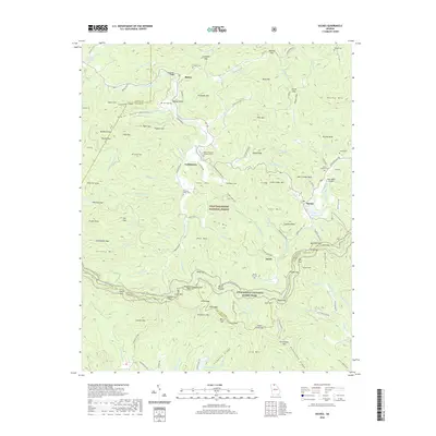
2020 Map of Suches
USGS Topo · Published 2020About this map
The Appalachian National Scenic Trail winds through this high-altitude landscape of the Chattahoochee National Forest, crossing prominent gaps and peaks along the Union and Lumpkin County line. The area is defined by its deep mountain coves and the headwaters of the Etowah River and Cooper Creek. Local centers like Suches, Sarah, and Gaddistown anchor the region, while the High Valley Airpark provides a modern touch to the traditional mountain geography.
Find a feature on this map
129 named features on this map. Tap any name to fly to it.
Don’t see what you’re looking for? This feature index may not catch every label — zoom into the map to look around manually.
Map Details
Editions of this 2020 Suches Map
This is the sole edition of this map. No revisions or reprints were ever made.
Other maps of this area

1886 · Dahlonega
USGS Topo · 1:125,000

1888 · Ellijay
USGS Topo · 1:125,000

1892 · Dahlonega
USGS Topo · 1:125,000

1892 · Ellijay
USGS Topo · 1:125,000

1896 · Dahlonega
USGS Topo · 1:125,000

1898 · Ellijay
USGS Topo · 1:125,000

1903 · Dahlonega
USGS Topo · 1:125,000

1911 · Ellijay
USGS Topo · 1:125,000

1935 · Coosa Bald
USGS Topo · 1:24,000

1935 · Mulky Gap
USGS Topo · 1:24,000