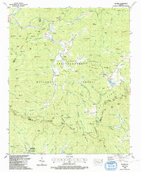
1988 Map of Suches
USGS Topo · Published 1991About this map
Suches sits at a high-elevation junction in the Blue Ridge Mountains of North Georgia, serving as a focal point for the surrounding Chattahoochee National Forest. In the late 1980s, this area maintained a rural, communal character defined by institutions like Woody Gap High Sch and a series of local congregations, including Mt Pleasant Ch No 2 and Pleasant Valley Ch. The landscape is heavily dissected by the upper reaches of the Toccoa River and Etowah River, with numerous gaps such as Cooper Gap and Horse Gap providing essential passage through the steep terrain. To the south, the presence of Camp Merrill (U S Army) introduces a military footprint into the wilderness. Smaller, remote settlements like Gaddistown and Baxter are connected by winding mountain roads, while family names are preserved on the landscape at sites like Woody Cem and Spriggs Cem.
Find a feature on this map
130 named features on this map. Tap any name to fly to it.
Don’t see what you’re looking for? This feature index may not catch every label — zoom into the map to look around manually.
Map Details
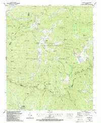
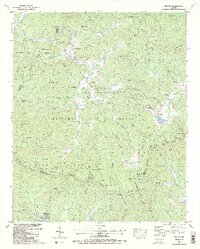
Editions of this 1988 Suches Map
3 editions found
Other maps of this area

1886 · Dahlonega
USGS Topo · 1:125,000

1888 · Ellijay
USGS Topo · 1:125,000

1892 · Dahlonega
USGS Topo · 1:125,000

1892 · Ellijay
USGS Topo · 1:125,000

1896 · Dahlonega
USGS Topo · 1:125,000

1898 · Ellijay
USGS Topo · 1:125,000

1903 · Dahlonega
USGS Topo · 1:125,000

1911 · Ellijay
USGS Topo · 1:125,000

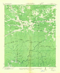
1935 · Coosa Bald
USGS Topo · 1:24,000
1935 · Mulky Gap
USGS Topo · 1:24,000