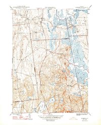
1948 Map of Sudbury
USGS Topo · Published 1948About this map
Hyde Manor stands as a significant landmark in the town of Sudbury, situated near the Hill Sch along what is now the Ethan Allen Memorial Highway. This 1940s landscape is defined by the complex water systems of the Lemon Fair River and Otter Creek, where the drainage of the Salisbury Swamp and Brandon Swamp historically shaped the local road and rail patterns. The Rutland railroad provides a primary transit corridor, crossing the map through Leicester Junction and Whiting. Educational history is well-represented by a high density of rural schools, including the Seth Warner Sch in the north and the Willow Brook Sch further south. The southern portion of the quadrangle transitions into a cluster of high-elevation water bodies like Burr Pond, Hinkum Pond, and High Pond near Stiles Mtn, suggesting a shift from the low-lying agricultural swamps to more upland terrain.
Find a feature on this map
61 named features on this map. Tap any name to fly to it.
Don’t see what you’re looking for? This feature index may not catch every label — zoom into the map to look around manually.
Map Details
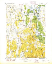
Editions of this 1948 Sudbury Map
2 editions found
Other maps of this area

1893 · Whitehall
USGS Topo · 1:62,500

1894 · Ticonderoga
USGS Topo · 1:62,500

1895 · Whitehall
USGS Topo · 1:62,500

1895 · Castleton
USGS Topo · 1:62,500

1896 · Ticonderoga
USGS Topo · 1:62,500

1897 · Castleton
USGS Topo · 1:62,500

1898 · Whitehall
USGS Topo · 1:62,500

1902 · Whitehall
USGS Topo · 1:62,500

1902 · Ticonderoga
USGS Topo · 1:62,500

1902 · Brandon
USGS Topo · 1:62,500