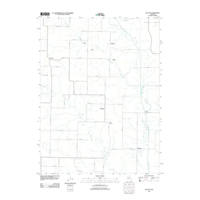
2012 Map of Sue City
USGS Topo · Published 2012About this map
Saling Branch meanders across this rural Missouri landscape, anchoring a network of small settlements and family burial grounds in the early 21st century. The map illustrates a agricultural community structured around the North Fork Salt River, where established locales like Sue City and Nickellton serve as local hubs. For genealogists, the distribution of small cemeteries is particularly noteworthy, including Cupp Cemetery, Bowan Cemetery, and Blanchard Cemetery, which are often the primary remaining evidence of early family landholdings. To the south, Lakeland sits near the riverbanks, while Rays Bridge provides a vital crossing point over the North Fork. The terrain is defined by a series of creeks, such as Bear Creek and Twomile Creek, which dictate the placement of local roads and farming boundaries throughout this portion of Shelby County.
Find a feature on this map
56 named features on this map. Tap any name to fly to it.
Don’t see what you’re looking for? This feature index may not catch every label — zoom into the map to look around manually.
Map Details
Editions of this 2012 Sue City Map
This is the sole edition of this map. No revisions or reprints were ever made.
Other maps of this area

1903 · Edina
USGS Topo · 1:125,000

1908 · Atlanta
USGS Topo · 1:62,500

1953 · Moberly
USGS Topo · 1:250,000

1954 · Centerville
USGS Topo · 1:250,000

1954 · Moberly
USGS Topo · 1:250,000

1957 · Moberly
USGS Topo · 1:250,000

1957 · Centerville
USGS Topo · 1:250,000

1958 · Centerville
USGS Topo · 1:250,000

1960 · Moberly
USGS Topo · 1:250,000
1963 · Leonard
USGS Topo · 1:24,000