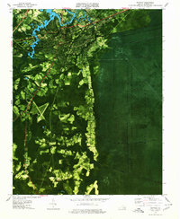
1977 Map of Suffolk
USGS Topo · Published 1978About this map
The Nansemond River and the edges of the Great Dismal Swamp National Wildlife Refuge anchor this landscape, illustrating the contrast between urban expansion and protected wetlands. The city of Suffolk appears as a dense hub of transit, where multiple rail lines including the Norfolk and Western RR and the Seaboard Coast Line RR converge. Beyond the city center, smaller communities like Skeetertown, Nurney, and Saunders are scattered among the agricultural clearings and swampy lowlands. To the east, the geometric lines of Jericho Ditch and Washington Ditch cut through the deep greens of the swamp, marking historic efforts to manage the water levels of this massive ecosystem. Notable local institutions like John F Kennedy High Sch and Nansemond High Sch serve the growing residential areas around Oak Grove and Pleasant Hill.
Find a feature on this map
41 named features on this map. Tap any name to fly to it.
Don’t see what you’re looking for? This feature index may not catch every label — zoom into the map to look around manually.
Map Details
Editions of this 1977 Suffolk Map
This is the sole edition of this map. No revisions or reprints were ever made.
Other maps of this area

1907 · Norfolk
USGS Topo · 1:125,000

1919 · Smithfield
USGS Topo · 1:62,500

1919 · Suffolk
USGS Topo · 1:62,500

1921 · Newport News
USGS Topo · 1:62,500

1940 · Lake Drummond
USGS Topo · 1:62,500

1944 · Windsor
USGS Topo · 1:31,680

1945 · Lake Drummond
USGS Topo · 1:62,500

1949 · Chuckatuck
USGS Topo · 1:24,000
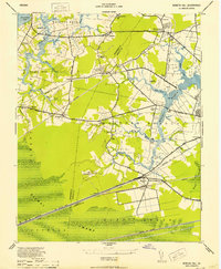
1952 · Bowers Hill
USGS Topo · 1:24,000

1953 · Norfolk
USGS Topo · 1:250,000