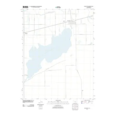
2010 Map of Sugar City
USGS Topo · Published 2010About this map
Lake Meredith Reservoir dominates this landscape in Crowley County, serving as a vital hydrologic hub for the surrounding agricultural plains. The intricate network of irrigation features, including the Sugar City Lateral, East Ordway Lateral, and the Horse Creek and and Black Draw Ditch, illustrates the sophisticated water management required for life in the high plains. On the western edge, the town of Ordway sits near its own Ordway Town Reservoir, while the community of Sugar City is situated just north of the lake near the Lakeview Cemetery. To the south, the sprawling terrain reaches toward Maurer Ranch, connected by a grid of section roads like County Road B and County Road D that define the local ranching and farming boundaries. The map provides a precise look at the drainage system feeding the reservoir, from Bob Creek to the engineered Lake Meredith Dam and its southern Lake Meredith Outlet.
Find a feature on this map
36 named features on this map. Tap any name to fly to it.
Don’t see what you’re looking for? This feature index may not catch every label — zoom into the map to look around manually.
Map Details
Editions of this 2010 Sugar City Map
This is the sole edition of this map. No revisions or reprints were ever made.
Other maps of this area

1891 · Catlin
USGS Topo · 1:125,000

1893 · Catlin
USGS Topo · 1:125,000

1953 · Cheraw
USGS Topo · 1:24,000

1954 · Meredith Hill
USGS Topo · 1:24,000

1954 · Sugar City
USGS Topo · 1:24,000

1954 · Ordway
USGS Topo · 1:24,000

1954 · Manzanola
USGS Topo · 1:24,000

1954 · Lamar
USGS Topo · 1:250,000

1955 · Rocky Ford
USGS Topo · 1:24,000

1958 · Lamar
USGS Topo · 1:250,000