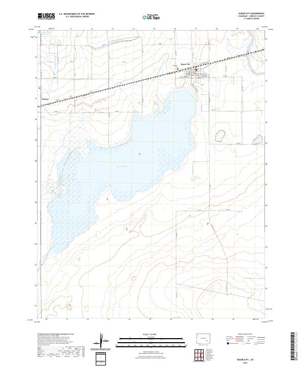
2022 Map of Sugar City
USGS Topo · Published 2022About this map
Sugar City and the eastern edge of Ordway anchor this high-plains landscape, where the local economy and geography are defined by a complex network of water management. The massive footprint of Lake Meredith dominates the center of the sheet, fed by the Lake Meredith Inlet and drained by the Lake Meredith Outlet. This hydraulic system is further articulated by the Sugar City Lateral and the And Black Draw Ditch, illustrating the intensive irrigation required for agriculture in Crowley County. Near the town of Sugar City, the Lakeview Cem and several residential streets like W Buffalo Ave and E Baltimore Ave provide clear landmarks for genealogical research. The map also captures the local transport corridors, including Highway 96 and Railroad Ave, which parallel the historical rail lines that once drove the sugar beet industry in this region.
Find a feature on this map
30 named features on this map. Tap any name to fly to it.
Don’t see what you’re looking for? This feature index may not catch every label — zoom into the map to look around manually.
Map Details
Editions of this 2022 Sugar City Map
This is the sole edition of this map. No revisions or reprints were ever made.
Other maps of this area

1891 · Catlin
USGS Topo · 1:125,000

1893 · Catlin
USGS Topo · 1:125,000

1953 · Cheraw
USGS Topo · 1:24,000

1954 · Meredith Hill
USGS Topo · 1:24,000

1954 · Sugar City
USGS Topo · 1:24,000

1954 · Ordway
USGS Topo · 1:24,000

1954 · Manzanola
USGS Topo · 1:24,000

1954 · Lamar
USGS Topo · 1:250,000

1955 · Rocky Ford
USGS Topo · 1:24,000

1958 · Lamar
USGS Topo · 1:250,000