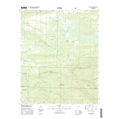
2017 Map of Sugar Grove
USGS Topo · Published 2017About this map
Sugar Grove and the nearby settlement of Grayson sit at the transition between the valley floor of the Petit Jean River and the rising slopes of the Ouachita National Forest. The landscape is defined by the sharp topography of Dry Creek Mtn and North Petit Jean Mtn, which frame a network of mountain trails and rugged access roads. Genealogists can find numerous family and community burial sites scattered across the township lines, including Ethan Davis Cem, Bud Davis Cem, and the Logan Cem near Logan Eddy. The southern portion of the map is dominated by the forest interior, where the Sugar Creek Hiking Trail and Hole In The Ground Mtn Trail weave through landmarks like Buck Ridge and Bald Knob. To the northeast, the waters of Blue Mountain Lake gather near the Third Bridge crossing, marking the primary drainage for the surrounding creeks.
Find a feature on this map
63 named features on this map. Tap any name to fly to it.
Don’t see what you’re looking for? This feature index may not catch every label — zoom into the map to look around manually.
Map Details
Editions of this 2017 Sugar Grove Map
This is the sole edition of this map. No revisions or reprints were ever made.
Other maps of this area

1879 · Mountain Home
USGS Topo · 1:62,500

1887 · Magazine Mountain #4
USGS Topo · 1:62,500

1887 · Mount Ida #2
USGS Topo · 1:62,500

1887 · Magazine Mountain #3
USGS Topo · 1:62,500

1887 · Magazine Mountain
USGS Topo · 1:62,500

1890 · Magazine Mountain
USGS Topo · 1:125,000

1890 · Mount Ida
USGS Topo · 1:125,000

1934 · Booneville
USGS Topo · 1:48,000

1939 · Booneville
USGS Topo · 1:62,500

1955 · Little Rock
USGS Topo · 1:250,000