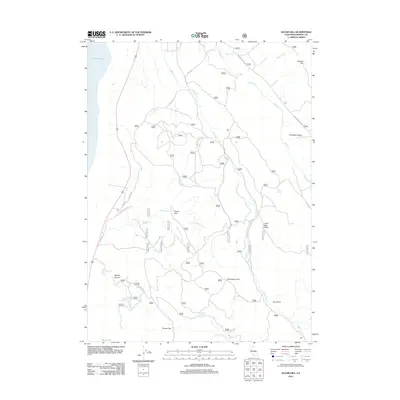
2012 Map of Sugar Hill
USGS Topo · Published 2012About this map
Sugar Hill rises as a prominent landmark in this northeastern corner of Modoc County, overlooking a landscape defined by seasonal water sources and historical transit routes. To the west, the expansive shoreline of Goose Lake dominates the horizon, while the eastern terrain is carved by Lassen Cr and Willow Cr. The map documents a network of flats and valleys, such as Cottonwood Flat, Harris Flat, and Fandango Valley, which suggest the area's long-standing use for high-country grazing.
Find a feature on this map
27 named features on this map. Tap any name to fly to it.
Don’t see what you’re looking for? This feature index may not catch every label — zoom into the map to look around manually.
Map Details
Editions of this 2012 Sugar Hill Map
This is the sole edition of this map. No revisions or reprints were ever made.
Other maps of this area

1886 · Alturas
USGS Topo · 1:250,000

1892 · Alturas
USGS Topo · 1:250,000

1954 · Alturas
USGS Topo · 1:250,000

1958 · Alturas
USGS Topo · 1:250,000

1962 · Alturas
USGS Topo · 1:250,000

1962 · Davis Creek
USGS Topo · 1:62,500

1962 · Willow Ranch
USGS Topo · 1:62,500

1962 · Cedarville
USGS Topo · 1:62,500

1962 · Fort Bidwell
USGS Topo · 1:62,500

1965 · Alturas
USGS Topo · 1:250,000