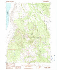
1990 Map of Sugar Hill
USGS Topo · Published 1990About this map
Modoc National Forest dominates the high-altitude landscape of this 1990 survey, centered on the prominent peak of Sugar Hill. To the west, the expansive shores of Goose Lake meet the foot of the hills, while the east is defined by the Warner Mountains and the historical Fandango Valley. The map records a significant historic landmark at the Site of Fandango Massacre, marking the cultural memory of the pioneer era along the old trails through the mountains.
Find a feature on this map
32 named features on this map. Tap any name to fly to it.
Don’t see what you’re looking for? This feature index may not catch every label — zoom into the map to look around manually.
Map Details
Editions of this 1990 Sugar Hill Map
This is the sole edition of this map. No revisions or reprints were ever made.
Other maps of this area

1886 · Alturas
USGS Topo · 1:250,000

1892 · Alturas
USGS Topo · 1:250,000

1954 · Alturas
USGS Topo · 1:250,000

1958 · Alturas
USGS Topo · 1:250,000

1962 · Alturas
USGS Topo · 1:250,000

1962 · Davis Creek
USGS Topo · 1:62,500

1962 · Willow Ranch
USGS Topo · 1:62,500

1962 · Cedarville
USGS Topo · 1:62,500

1962 · Fort Bidwell
USGS Topo · 1:62,500

1965 · Alturas
USGS Topo · 1:250,000