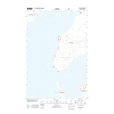
2013 Map of Sugar Point
USGS Topo · Published 2013About this map
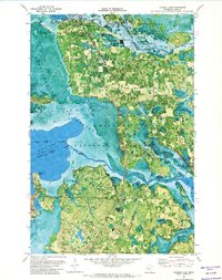
Leech Lake dominates this landscape, framing a series of prominent peninsulas and islands within the Chippewa National Forest. The settlement of Federal Dam sits at the northern edge of the sheet, serving as a focal point for the surrounding wetlands and forests. The mapping of the Leech Lake Indian Reservation area is marked by several named points such as Fivemile Point, Sugar Point, and Battle Point, each connected by a network of forest roads including Co Hwy 73 NW and Battle Point Dr NW. Genealogy and local history researchers will find the White Cloud Cem situated on the western shore of the main peninsula. Further south, the large landmass of Bear Island rises from the water, while smaller features like Bobo Link Lake dot the interior woodlands, illustrating the complex shoreline and water-dominated geography of north-central Minnesota.
Find a feature on this map
14 named features on this map. Tap any name to fly to it.
Don’t see what you’re looking for? This feature index may not catch every label — zoom into the map to look around manually.
Map Details
Editions of this 2013 Sugar Point Map
This is the sole edition of this map. No revisions or reprints were ever made.
Other maps of this area

1954 · Bemidji
USGS Topo · 1:250,000

1957 · Bemidji
USGS Topo · 1:250,000

1958 · Bemidji
USGS Topo · 1:250,000
1971 · Jack Lake
USGS Topo · 1:24,000

1971 · Bena
USGS Topo · 1:24,000
1971 · Town Line Lake
USGS Topo · 1:24,000
1971 · Whipholt
USGS Topo · 1:24,000

1971 · Sucker Lakes
USGS Topo · 1:24,000
1971 · Federal Dam
USGS Topo · 1:24,000

1971 · Portage Lake
USGS Topo · 1:24,000