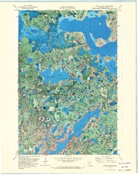
1971 Map of Town Line Lake
USGS Topo · Published 1974About this map
Chippewa National Forest defines the dense, wooded character of this Northwoods landscape in Cass County. This 1971 orthophotomap provides a rare hybrid view, combining traditional topographic contours with high-altitude aerial imagery taken in 1969. The intricate network of glacial lakes is the primary feature, including Boy Lake with its prominent Headquarters Bay and the narrow, winding stretch of Long Lake. The map captures small pockets of human presence amidst the timber and wetlands, such as Church Camp on the shores of Rabbit Lake and St Edwards Cem near the southern shore of Town Line Lake. The combination of photographic detail and elevation lines offers a unique insight into the transition between water and marsh, illustrating the complex shoreline of bodies like Mad Dog Lake and Inguadona Lake at a specific moment in the early 1970s.
Find a feature on this map
31 named features on this map. Tap any name to fly to it.
Don’t see what you’re looking for? This feature index may not catch every label — zoom into the map to look around manually.
Map Details
Editions of this 1971 Town Line Lake Map
This is the sole edition of this map. No revisions or reprints were ever made.
Other maps of this area

1953 · Brainerd
USGS Topo · 1:250,000

1954 · Bemidji
USGS Topo · 1:250,000

1957 · Brainerd
USGS Topo · 1:250,000

1957 · Bemidji
USGS Topo · 1:250,000

1958 · Bemidji
USGS Topo · 1:250,000

1958 · Brainerd
USGS Topo · 1:250,000

1965 · Brainerd
USGS Topo · 1:250,000

1970 · Laura Lake
USGS Topo · 1:24,000

1970 · Woman Lake
USGS Topo · 1:24,000
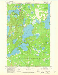
1971 · Longville
USGS Topo · 1:24,000