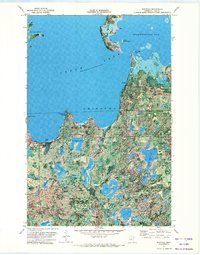
1971 Map of Whipholt
USGS Topo · Published 1974About this map
Leech Lake dominates this 1970s orthophotomap, showing the sprawling southern shoreline within the Chippewa National Forest. The settlement of Whipholt sits near the southwestern shore, while Brevik occupies a narrow peninsula to the east, providing a clear look at the region's mid-century recreational and residential layout. This specialized map format combines traditional topographic contours with aerial photography, revealing the dense woodland texture and the complex network of smaller water bodies such as Wawa Lake, Cedar Lake, and Three Island Lake that characterize this glacial landscape.
Find a feature on this map
37 named features on this map. Tap any name to fly to it.
Don’t see what you’re looking for? This feature index may not catch every label — zoom into the map to look around manually.
Map Details
Editions of this 1971 Whipholt Map
This is the sole edition of this map. No revisions or reprints were ever made.
Other maps of this area

1953 · Brainerd
USGS Topo · 1:250,000

1954 · Bemidji
USGS Topo · 1:250,000

1957 · Brainerd
USGS Topo · 1:250,000

1957 · Bemidji
USGS Topo · 1:250,000

1958 · Bemidji
USGS Topo · 1:250,000

1958 · Brainerd
USGS Topo · 1:250,000

1965 · Brainerd
USGS Topo · 1:250,000

1970 · Webb Lake
USGS Topo · 1:24,000

1970 · Woman Lake
USGS Topo · 1:24,000
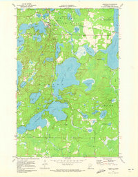
1971 · Longville
USGS Topo · 1:24,000