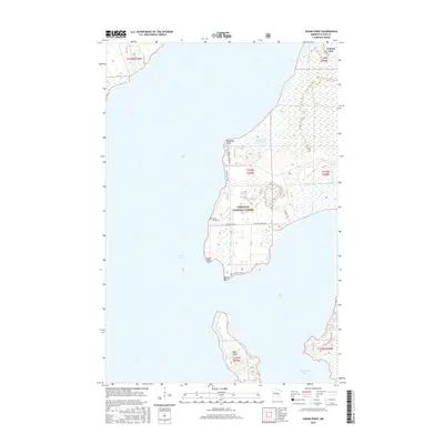
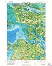
2016 Map of Sugar Point
USGS Topo · Published 2016About this map
Leech Lake defines this landscape, where the waters of Boy Bay and Headquarters Bay meet the irregular shorelines of the Chippewa National Forest. The map focuses on the prominent peninsula terminating at Sugar Point and Battle Point, an area marked by the extensive Sugar Point Bog and the isolated Bear Island to the south.
Find a feature on this map
26 named features on this map. Tap any name to fly to it.
Don’t see what you’re looking for? This feature index may not catch every label — zoom into the map to look around manually.
Map Details
Editions of this 2016 Sugar Point Map
This is the sole edition of this map. No revisions or reprints were ever made.
Other maps of this area

1954 · Bemidji
USGS Topo · 1:250,000

1957 · Bemidji
USGS Topo · 1:250,000

1958 · Bemidji
USGS Topo · 1:250,000
1971 · Jack Lake
USGS Topo · 1:24,000

1971 · Bena
USGS Topo · 1:24,000
1971 · Town Line Lake
USGS Topo · 1:24,000
1971 · Whipholt
USGS Topo · 1:24,000

1971 · Sucker Lakes
USGS Topo · 1:24,000
1971 · Federal Dam
USGS Topo · 1:24,000

1971 · Portage Lake
USGS Topo · 1:24,000