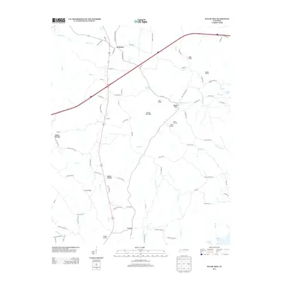
2013 Map of Sugar Tree
USGS Topo · Published 2013About this map
Sugar Tree sits at the heart of this West Tennessee landscape, where the terrain is defined by a dense network of ridges and hollows leading toward Kentucky Lake. The settlement pattern follows the high ground and winding creek beds, connected by local routes like Spence Store Loop and Liniell Mills Loop. Small communities such as Cozette, Mclllwain, and Akins Chapel are distributed along the central corridor, often centered near local landmarks like Bumble Bee Ridge or the watercourses of Eagle Cr and Sugar Tree Fork.
Find a feature on this map
93 named features on this map. Tap any name to fly to it.
Don’t see what you’re looking for? This feature index may not catch every label — zoom into the map to look around manually.
Map Details
Editions of this 2013 Sugar Tree Map
This is the sole edition of this map. No revisions or reprints were ever made.
Other maps of this area

1936 · Pine View
USGS Topo · 1:24,000

1936 · Parsons
USGS Topo · 1:24,000

1936 · Seventeen Creek
USGS Topo · 1:24,000

1936 · Daniels Landing
USGS Topo · 1:24,000

1936 · Jeannette
USGS Topo · 1:24,000

1936 · Sugar Tree
USGS Topo · 1:24,000

1936 · Cavvia
USGS Topo · 1:24,000

1936 · Rockport
USGS Topo · 1:24,000

1936 · Hustburg
USGS Topo · 1:24,000

1949 · Daniels Landing
USGS Topo · 1:24,000