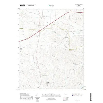
2019 Map of Sugar Tree
USGS Topo · Published 2019About this map
Sugar Tree and the surrounding borderlands of Benton and Decatur Counties are defined by a complex network of ridges and hollows carved by the many tributaries of the Tennessee River basin. The landscape is marked by small settlements like Cozette and McIllwain, which are connected by winding routes such as Co Hwy 905 and Sugar Tree School Rd. The density of cemeteries, including Bawcum Cem, Haynes Cem, and Hartley Cem, suggests a long history of family homesteads established in the valleys of Lick Cr and Morgan Cr. This 2019 survey shows how modern infrastructure, notably the highway bisecting the northern portion, intersects with the traditional topography of places like Bumble Bee Ridge and Blue Hollow. The presence of features like Morris Spring and Sugar Tree Fork underscores the enduring importance of the local hydrology to this rural Tennessee community.
Find a feature on this map
99 named features on this map. Tap any name to fly to it.
Don’t see what you’re looking for? This feature index may not catch every label — zoom into the map to look around manually.
Map Details
Editions of this 2019 Sugar Tree Map
This is the sole edition of this map. No revisions or reprints were ever made.
Other maps of this area

1936 · Pine View
USGS Topo · 1:24,000

1936 · Parsons
USGS Topo · 1:24,000

1936 · Seventeen Creek
USGS Topo · 1:24,000

1936 · Daniels Landing
USGS Topo · 1:24,000

1936 · Jeannette
USGS Topo · 1:24,000

1936 · Sugar Tree
USGS Topo · 1:24,000

1936 · Cavvia
USGS Topo · 1:24,000

1936 · Rockport
USGS Topo · 1:24,000

1936 · Hustburg
USGS Topo · 1:24,000

1949 · Daniels Landing
USGS Topo · 1:24,000