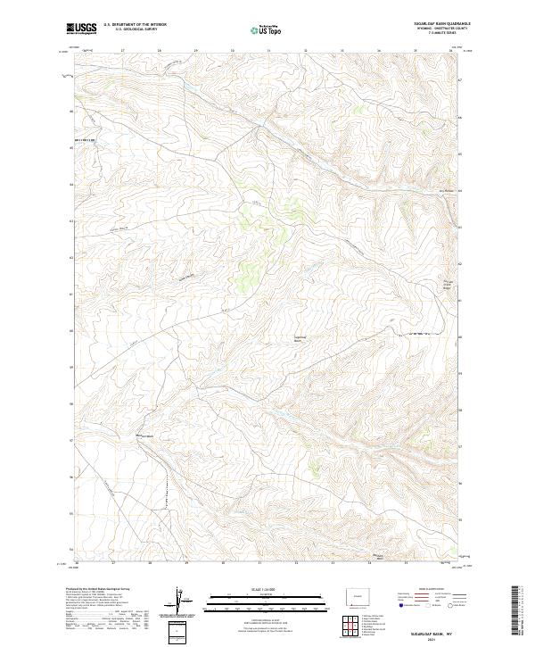
2021 Map of Sugarloaf Basin
USGS Topo · Published 2021About this map
Sugarloaf Basin and the winding drainages of Sugarloaf Marsh Cr define this high-elevation landscape in Sweetwater County. The terrain is characterized by a series of significant washes and canyons, most notably Washam Wash and Lowe Canyon, which channel seasonal water through the dry basins. The map documents a network of rural access routes, including Flaming Gorge Rd and Currant Creek Rd, which navigate the elevation changes between Currant Creek Ridge and the lower flats. Local water sources like Washam Spring appear as critical landmarks in an otherwise arid environment. This 2021 survey reveals a modern snapshot of the public land survey system, clearly demarcating the townships and ranges that organize this remote part of Wyoming.
Find a feature on this map
19 named features on this map. Tap any name to fly to it.
Don’t see what you’re looking for? This feature index may not catch every label — zoom into the map to look around manually.
Map Details
Editions of this 2021 Sugarloaf Basin Map
This is the sole edition of this map. No revisions or reprints were ever made.
Other maps of this area

1954 · Rock Springs
USGS Topo · 1:250,000

1957 · Currant Creek Ranch
USGS Topo · 1:62,500

1957 · Mc Kinnon Junction
USGS Topo · 1:62,500

1957 · Firehole Basin
USGS Topo · 1:62,500

1958 · Rock Springs
USGS Topo · 1:250,000

1962 · Rock Springs
USGS Topo · 1:250,000

1966 · Firehole Basin
USGS Topo · 1:62,500

1966 · Mc Kinnon Junction
USGS Topo · 1:62,500

1966 · Buckboard Crossing
USGS Topo · 1:62,500

1966 · Currant Creek Ranch
USGS Topo · 1:62,500