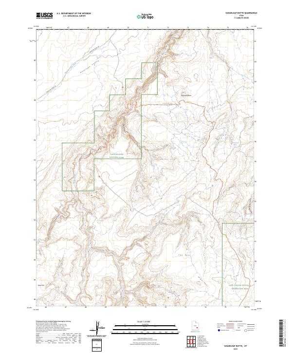
2023 Map of Sugarloaf Butte
USGS Topo · Published 2023About this map
Deep drainage systems and high desert plateau features characterize this portion of Utah's canyon country within Canyonlands National Park. The landscape is dominated by the intricate branching of Horseshoe Canyon and its tributaries, including Barrier Creek and Bluejohn Canyon, which cut through the underlying geological strata toward the Green River basin. High ground is marked by prominent landmarks such as Sugarloaf Butte and the elongated landform of The Spur.
Find a feature on this map
20 named features on this map. Tap any name to fly to it.
Don’t see what you’re looking for? This feature index may not catch every label — zoom into the map to look around manually.
Map Details
Editions of this 2023 Sugarloaf Butte Map
This is the sole edition of this map. No revisions or reprints were ever made.
Other maps of this area

1885 · San Rafael
USGS Topo · 1:250,000

1952 · Tidwell 4 SE
USGS Topo · 1:24,000

1953 · Orange Cliffs 1 SE
USGS Topo · 1:24,000

1953 · Orange Cliffs 1 NE
USGS Topo · 1:24,000

1953 · The Spur
USGS Topo · 1:62,500

1956 · Salina
USGS Topo · 1:250,000

1960 · Salina
USGS Topo · 1:250,000

1962 · Salina
USGS Topo · 1:250,000

1963 · Robbers Roost Canyon
USGS Topo · 1:62,500
1963 · Bowknot Bend
USGS Topo · 1:62,500