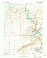
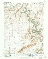
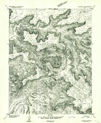
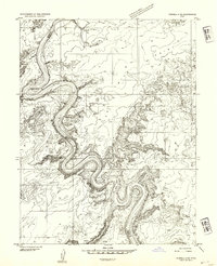
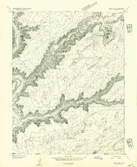
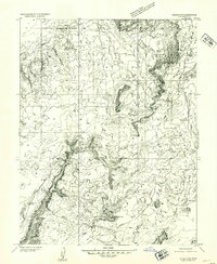
1963 Map of Bowknot Bend
USGS Topo · Published 1965About this map
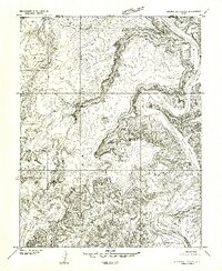
The Green River carves a serpentine path through this 1963 survey of Emery and Grand Counties, most notably at the dramatic hairpin turn of Bowknot Bend. This stretch of the river, deep in the Labyrinth Canyon region, shows the intersection of natural hydrology and early 20th-century resource extraction. The Hey Joe Mine is visible along the riverbank, linked by precarious jeep trails that weave through the canyon complex. To the west, the San Rafael Valley and Antelope Valley provide a stark contrast to the river corridors, characterized by numerous stock watering points such as Kirby Pond and Antelope Valley No 3 Res. The presence of Spring Canyon Ford and multiple named landing strips indicates how travelers negotiated this isolated terrain before modern infrastructure. Numerous family-named landmarks like Gruvers Wash and Tidwell Bottom suggest the history of local ranching and prospecting efforts.
Find a feature on this map
59 named features on this map. Tap any name to fly to it.
Don’t see what you’re looking for? This feature index may not catch every label — zoom into the map to look around manually.
Map Details
Editions of this 1963 Bowknot Bend Map
2 editions found
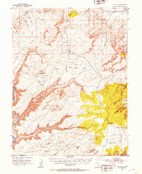
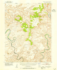
Other maps of this area

1885 · San Rafael
USGS Topo · 1:250,000

1885 · La Sal
USGS Topo · 1:250,000
1951 · The Knoll
USGS Topo · 1:62,500
1951 · Upheaval Dome
USGS Topo · 1:62,500

1952 · Tidwell 4 SE
USGS Topo · 1:24,000
1952 · Carlisle 2 NW
USGS Topo · 1:24,000
1952 · Tidwell 4 NE
USGS Topo · 1:24,000
1952 · Moab 3 SW
USGS Topo · 1:24,000
1952 · Moab 3 NW
USGS Topo · 1:24,000
1953 · Orange Cliffs 1 NE
USGS Topo · 1:24,000