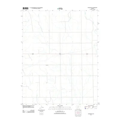
2012 Map of Sugarloaf
USGS Topo · Published 2012About this map
Sugarloaf stands as a prominent terrain feature in this portion of Comanche County, Kansas. The 2012 survey illustrates a landscape defined by natural drainages and modern infrastructure, where Bluff Cr and Buzzard Cr wind through the prairie terrain. The region's transport network is anchored by the shared alignment of Highway 160 and 183, which cuts a straight line across the center of the sheet. This topographic study reflects the rural character of the High Plains, showing how contemporary road systems and natural watercourses intersect in this sparsely settled area of the state.
Find a feature on this map
4 named features on this map. Tap any name to fly to it.
Don’t see what you’re looking for? This feature index may not catch every label — zoom into the map to look around manually.
Map Details
Editions of this 2012 Sugarloaf Map
This is the sole edition of this map. No revisions or reprints were ever made.
Other maps of this area

1892 · Coldwater
USGS Topo · 1:125,000

1894 · Sitka
USGS Topo · 1:62,500

1896 · Ashland
USGS Topo · 1:125,000

1955 · Pratt
USGS Topo · 1:250,000

1959 · Pratt
USGS Topo · 1:250,000

1979 · Sitka
USGS Topo · 1:24,000

1979 · Sugarloaf
USGS Topo · 1:24,000

1979 · East Kiowa Creek South
USGS Topo · 1:24,000
1979 · Sitka SW
USGS Topo · 1:24,000
1979 · Lexington
USGS Topo · 1:24,000