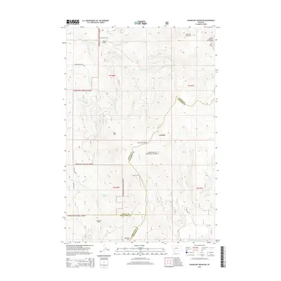
2014 Map of Sugarloaf Mountain
USGS Topo · Published 2014About this map
Sugarloaf Mountain and Cliff Mtn dominate this high-altitude landscape along the Continental Divide, where the boundaries of Powell, Jefferson, and Deer Lodge counties meet. The settlement of Leadville serves as a primary reference point in a region defined by complex drainage systems, including the Boulder River and Cottonwood Cr headwaters. Industrial and historical interest is anchored by Schurchs Tunnel, located just west of Indian Cr, hinting at the mining legacy of these mountains. The terrain is a network of named peaks and ridges such as Black Mtn, Saratoga Mtn, and Blizzard Hill, much of which is protected within the Deerlodge National Forest and Helena National Forest. Road access is limited to mountain routes like Spring Emery Rd and Rock Creek Rd, reflecting the remote and topographic character of the Montana high country.
Find a feature on this map
39 named features on this map. Tap any name to fly to it.
Don’t see what you’re looking for? This feature index may not catch every label — zoom into the map to look around manually.
Map Details
Editions of this 2014 Sugarloaf Mountain Map
This is the sole edition of this map. No revisions or reprints were ever made.
Other maps of this area

1889 · Helena
USGS Topo · 1:250,000

1893 · Helena
USGS Topo · 1:250,000

1899 · Boulder
USGS Topo · 1:125,000

1899 · Helena
USGS Topo · 1:250,000

1903 · Helena
USGS Topo · 1:250,000

1947 · Butte
USGS Topo · 1:250,000

1954 · Elk Park
USGS Topo · 1:62,500

1954 · Basin
USGS Topo · 1:62,500

1958 · Butte
USGS Topo · 1:250,000

1959 · Butte North
USGS Topo · 1:62,500