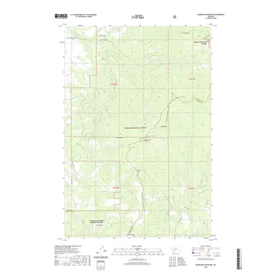
2020 Map of Sugarloaf Mountain
USGS Topo · Published 2020About this map
The Continental Divide winds through the center of this high-elevation landscape, marking the boundary between Deerlodge National Forest and Helena National Forest. The small settlement of Leadville sits just west of the divide, reflecting the region's mining heritage alongside Schurchs Tunnel to the south. The terrain is defined by a series of prominent peaks, including Sugarloaf Mtn in the northeast and Saratoga Mtn near the southern edge. The watershed is intricately carved by numerous drainages such as Rocker Gulch and the headwaters of the Boulder River. This 2020 survey reveals the complex network of forest roads like Rock Creek Rd and the prominent Continental Divide National Scenic Trail, which traces the ridgelines through some of Montana's most significant wilderness areas.
Find a feature on this map
41 named features on this map. Tap any name to fly to it.
Don’t see what you’re looking for? This feature index may not catch every label — zoom into the map to look around manually.
Map Details
Editions of this 2020 Sugarloaf Mountain Map
This is the sole edition of this map. No revisions or reprints were ever made.
Other maps of this area

1889 · Helena
USGS Topo · 1:250,000

1893 · Helena
USGS Topo · 1:250,000

1899 · Boulder
USGS Topo · 1:125,000

1899 · Helena
USGS Topo · 1:250,000

1903 · Helena
USGS Topo · 1:250,000

1947 · Butte
USGS Topo · 1:250,000

1954 · Elk Park
USGS Topo · 1:62,500

1954 · Basin
USGS Topo · 1:62,500

1958 · Butte
USGS Topo · 1:250,000

1959 · Butte North
USGS Topo · 1:62,500